This circular walk takes you to a secluded valley with a fascinating wetland habitat.
Length: 2½ km (1½ miles) – a bit over 3,000 steps. It should take a bit over 1 hour (plus lingering near the pond).
Start and Finish: St Pol Car park
How Strenuous: A steady then sharp uphill climb before an easy descent.
How Uneven? Mainly good tracks but the path through the woods can be muddy.
Obstacles: Parts are uneven so unsuitable for wheelchairs or buggies.
- Leaving the car park turn left down the pedestrianised road called Bridgegate.
- Pass the fustian knife in Saint Georges Square, head past the mill and the White Lion pub where you turn left up the main Keighley Road
- Walk for about 300 metres to a set of traffic lights where you cross the road. Head up hill for 30 metres and turn right up a track before the former Nutclough Tavern.
- At the gate keep left, after a 50 metre gentle climb, at a stone wall turn left up a short flight of stone steps.
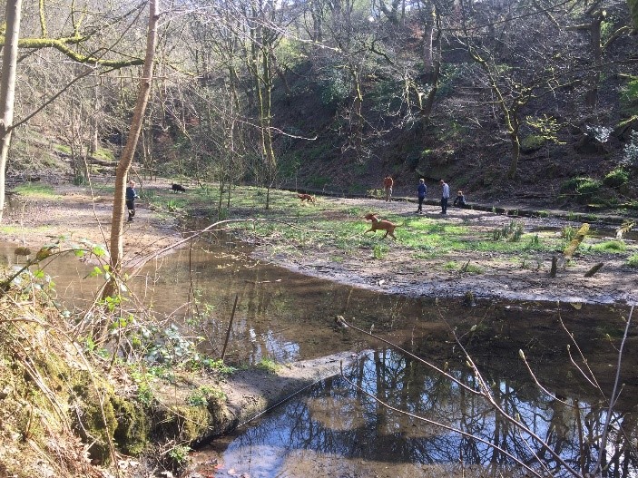
- You will now see the Nutclough Mill pond on your right with some benches to stop and sit or you can wander round the paths. You may see some unusual birds and if you’ve got children, they will want to play in the water but do take care as there are some deep spots.
The pond in Nutclough used to be an old mill dam to supply water to a sawmill.
- To continue the walk, take the stone steps up to a footpath (marked link path) which rises up on the left-hand side above the pond.
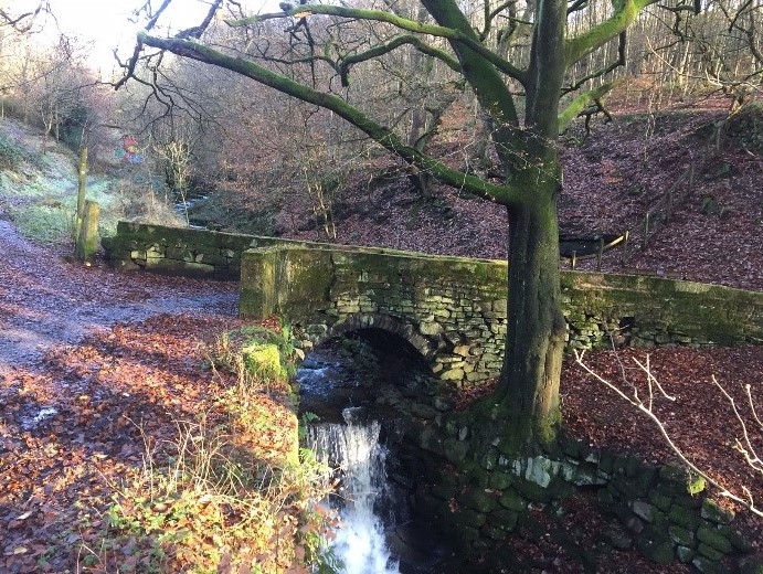
- Where it levels out go on to the 18th century Hurst Bridge (see photo) for a great view down Nutclough valley
- Retrace your steps from the bridge for 30 metres and take the wide stone path up to your buy tramadol texas right. The path narrows and you pass Hurst which is an old farm and then reach a terrace of early 20th century houses on a tarmac road. Great views of the valley bottom from here.
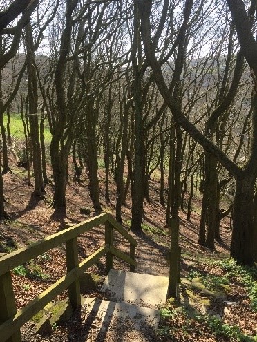
- Continue ahead and just before the next set of houses there is a footpath going down to your left. This goes down a set of stone steps into some fine beech woods (take care as this woodland path is quite steep and can be a bit slippery).
- The path bends to the right and drops down to the bottom of the wood where you take a narrow path down some stone steps. This ends up on the main Keighley Road (a little above the traffic lights you crossed earlier).
To return to the centre, you have two choices:
If you are short of time, you can walk down the main road which will take you about ten minutes.
Or a more interesting route is through the back of the town, described below.
- Cross the main road and take Lees Road going down behind the bus stop.
- Turn sharp right into Unity Street, then shortly after, on the left, watch out for a narrow set of steep stone steps going down between two houses (number 7 and 9).
- At the bottom of the steps, cross the road, slightly to your left, to another set of concrete steps and then down through the estate car park on to a road called Victoria Road near a playground.
- Turn left here and follow the road for 100 metres, over the river and past some industrial buildings.
- Turn left just before the funeral directors and at the end turn right along the riverside path. The path emerges opposite the town hall. Turn left over the bridge and you will see the fustian needle in St Georges Square. Turn right on to Bridgegate back to St. Pol car park where you first started.