HEBDEN BRIDGE WALKERS ACTION
906 BUS WALKS 3
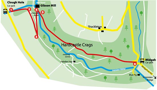
Widdop Gate to Gibson Mill
via old railway and stone steps
Main features of the walk
This is a short circular walk mainly in woodland and partly following the route of an old railway line used to build local reservoirs.
Length and time
It’s about 3km (approx 2 miles) and should take you about 1½ hours (+ stops).
Gradients – how strenuous?
This walk is mainly a gentle descent with two steep flights of stone steps – one up and one down.
Terrain – how uneven?
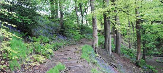
The walk is all on a good paths but they are quite uneven in several places.
Obstacles – stiles, steps etc.
There are two stiles with gate alternatives.
Facilities on the walk
At Gibson Mill there are toilets, the HBWA stone steps photo mosaic and the Weaving Shed café (if you show your bus ticket you can have a free hot drink in the café). There are also toilets at Midgehole. There is usually no mobile signal on this walk.
What to take?
The walk is quite sheltered, but parts of the path can be pretty muddy, especially after rain, so you need some decent footwear
Detailed directions for walk 3: Widdop Gate to Gibson Mill via old railway and stone steps
This walk starts at the 906 bus stop at Widdop Gate.
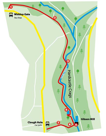
- Cross the road and walk back ten metres to take a way-marked path through a wooden gate. The path drops down and then becomes a set of stone steps. At the bottom of the first flight, turn right at a signpost. You are now on the route of an old railway line.
A note about the railway line
The railway was built in about 1900 to bring materials for the construction of the reservoirs higher up the hillside. The stream at Blake Dean, in front of you was crossed by a huge wooden trestle bridge regarded locally as the eighth wonder of the world.
- After ½ km you reach a signpost where you keep straight ahead. Shortly after, the path begins to go gently downhill.
- After ½ km the path reaches the river which you now follow downstream on a partly paved rough path.
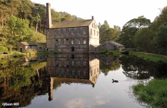
- After another ½ km you reach a mill pond which you walk around. At the far end of the pond, take a set of stone steps and continue following the river. After 200 metres you arrive at Gibson Mill, where a stop for refreshment would be in order.
- You now have a choice: to finish the walk will take you about 25 minutes to get up to the bus stop at the Clough Hole National Trust car park, so check the timetable and if it fits, fine. If there’s a long wait, you might want to consider walking down to Midgehole bus stop, using the routes from Walks 1 and 2.
- Return over the bridge and take the fantastic flight of stone steps opposite. At the top of the steps you arrive at a path where you turn right. This path joins a track, where you turn right again, heading uphill.
- Pass through two stiles by gates and then take the short flight of steps up to Clough Hole car park where you can catch the 906 bus back to Hebden Bridge.