This circular walk through heather moors is probably the most demanding of all the walks with a long initial incline, but it is on well defined paths and you will be rewarded by several unique panoramic views. Walking through heather moors in the mist can be very disorientating, so don’t attempt to do this walk in poor weather.
Length and time
3 miles, taking about 2 – 2½ hours.
Gradients – how strenuous
The first mile is uphill, but not too steep, but once on the moors it is pretty flat.
Terrain – how uneven
Most of the walk is on clear paths and tracks, but some stretches are a bit uneven. After rain, a few bits can be soft or even muddy. There is one very short steep slope where you have to take it carefully.
Obstacles – stiles, steps etc.
There are three wooden stiles on this walk, but they are all in good condition.
Facilities
A fine bench near Churn Milk Joan and Lane ends pub if you add ½ mile walk along the road at the end.
Points of interest
This walk provides wonderful views, but also you are also likely to see pheasants, partridge and other upland birds. Churn Milk Joan is a seventeeth century seven foot local standing stone – you might want to leave a coin on the top – people usually do.
DIRECTIONS
Before you start, you should look at the Hebden Bridger bus timetable or pick up a copy from Hebden Bridge Tourist information Centre.
Take the 595 bus to Old Town and ask to be let off at the Mount Skip. The large dwelling here used to be a popular pub until it closed down a few years ago. To the left of the building is a tarmac road up to the Hebden Bridge (Mount Skip) Golf Club (this access road is a public right of way).
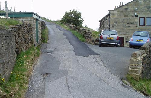
The start of the walk at the Mount Skip
Go up the tarmac road for about 100 yards, until you reach the golf club sign before a cattle grid and take the rough grass track that goes off to the left (following the wall on your right). The track skirts the edge of the golf course and passes some old delphs (quarries) on your left – now used as a motor bike scrambles.
After about 200 yards you will see a finger post and stile through the wall (ignore the stile at the blue and white pole). There is a gate a little farther on if that is easier.
The stile on to the golf course path
The path goes straight across the golf course (a slight incline), passing a line of small trees to a clearly visible wooden stile (the route of the path itself is indistinct).
Once across the stile follow the small path up to your right which after a few yards joins the Calderdale Way on a well defined track; turn right here. The track which runs behind the club house is clearly defined, keeping quite straight (ignore path going off to the right) and going slightly up hill until you reach a metal gate and wooden stile.
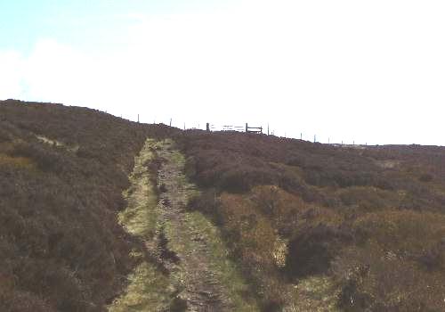
Gateway to the moors
Once over the stile the path is straight ahead through heather (again keep to the Calderdale Way and ignore the path going off to the right). The path is flat, with a paved section because some bits can be a bit boggy. The path joins a fine stone wall on your right which you follow.
After a short distance you come to a fork, take the left path which http://healthsavy.com/product/amoxicillin/ goes away from the wall until you reach Cranley’s seat which is an excellent place to stop and admire the view.
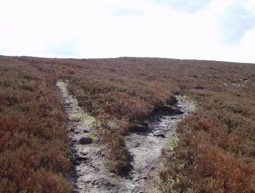
After a short distance you reach a stone pillar called Churn Milk Joan where five paths meet. Take the clear path which goes off sharply to your left through heather (slightly doubling back on yourself).
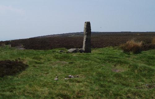
Churn Milk Joan
You have just come along the path on the left of the photo and need to do a 90 degree turn to the left.
You now have just under a mile walking slightly uphill on a clear path through the heather moors where you will see (or hear) some game birds and skylarks. The windfarm at Ovenden Moor comes in to view and don’t be surprised if you also see dingy sails in the distance as there is a hidden reservoir.
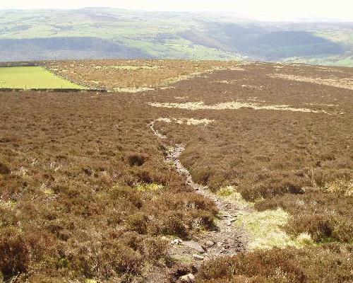
As soon as you feel the path beginning to descend watch out for a fork where you turn sharply left, almost doubling back on yourself. This is another good place to stop and look at the panoramic views including Heptonstall and Old Town mill, (both of which are below you).
Looking back at the fork
You have come on the left hand path and will be heading away on the right hand path.
The path you take is again through heather moors, the route is quite straight and clear, but ignore ill defined sheep paths. After about ½ mile you reach a white painted trig point with a 350 degree panoramic view.
From the trig point the path bears right and after a short time you reach some uneven ground which are old stone workings. Here there is a short steep down hill, where we suggest you take a small path to the right and zig zag down to the bottom of the steep bit of the slope.
The path continuing straight ahead from the slope
(a little uneven in places)
After a short time you reach a junction with the Calderdale Way (you will see the double finger post) where you turn right – you are now on the route you took at the beginning of the walk. Head down the track towards the stile and gate (ignore the less defined path going off to the right).
Through the gate the track goes down hill towards the club house. Just past the club house a small path goes off to the left to a gate and stile which takes you into the golf course.
Here you have the option of extending the walk by doing the Above Old Town walk which would be an extra 2½ miles – perhaps a step too far! Assuming you have had enough….
The grass path becomes a gravel path which in turn joins the tarmac road taking you through the golf club car park. This road is a right of way, but obviously watch out for golfers taking shots. The tarmac road takes you back down to the Mount Skip.
To get back to Hebden Bridge, you have two options:
- You can stop the A and B bus going either way.
- If you walk ½ mile along the road to your right (take care on the nasty bend where you should watch out for cars) you come to the Hare and Hounds pub (known locally as Lane Ends) where you might want to delay your return (check the bus times on the nearby bus stop before you go to the pub)
A car alternative
Turn left at the Mount Skip junction and you can park your car on the verge a few yards on the right.