Author Archives: a1anpmcd0

News 2012 and earlier

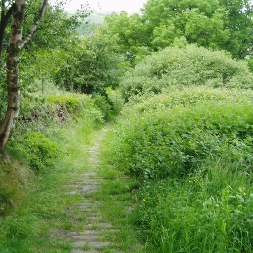
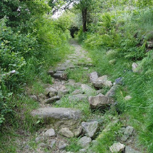
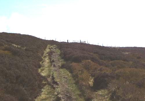
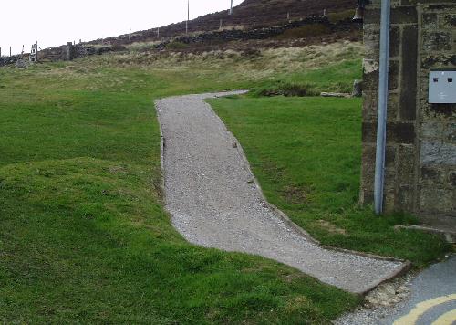
New path from Hebden to to Hardcastle Craggs (June 2012)

This is a long standing issue HBWA has done work on in the past. We have now identified a possible source of funding, so are consulting interested parties to see whether they are interested in forming a consortium to make a bid.

Med per Uomo

The future of Calderdale Countryside Service (June 2012)

At the end of May Calderdale Council called a meeting of staff, volunteers and oter interested groups to discuss future priorities and issue. The session was very well attended and in July we expect to have sight of any proposals that emerge from the meeting.

The future of Calderdale Countryside Service (April 2012)

Rumours abound, first that it was to be abolished, then it was reprieved, then it was to be handed over to another organisation, then Amey were going to do all the work. The current news from the volunteers is

  • The budget for 2012-3 is the same as last year
  • £1500 has been allocated to upgrading the worst bits of the Calderdale way
  • No decision has been made about the long term future (wait until after the election perhaps?)

New season of Calderdale Heritage walks (April 2012)

Walks for 2012 have just been published. There are leaflets in Toursist Information Centres and other outlets or you can download the details from the Calderdale Heritage Walks website.

Pennine Horizon E-Trails (April 2012)

Following the two pilot e-Trails done in 2010, Pennine Horizons have funding to produce a dozen more. Agreed topics so far are Cragg Valley, yeomans Housing in Barkisland and Norland, Geology, Trees, The Fielden family. If anyone is interested in helping develop new E-trails, contact Pennine Horizons.

National Trail in Hebden Bridge (March 2012)

We all know that the Pennine Way passes through close to Hebden bridge, but did you know that there are a number of National Trails off the Pennine Way? One of them is the Hebden Bridge Round – a 12km circular walk.

On line Ordinance Survey (March 2012)

You can access OS maps for Calderdale on Calderdale Council’s website. There is the facility for zooming in on a particular area. If you have a smart phone bookmark the site in case you get lost!

Gentle walking (March 2012)

Hebden Bridge Walkers Action’s Gentle Walking leaflet rapidly went out of print. We have now got a reprint under way (thank you to the town council for grant support for this).

Two more walk leaflets (Feb 2012)

These are for a walk in the Cragg Vale valley and the footpaths in Eaves Wood, Mytholm. These are available from Hebden Bridge Visitor Centre and other local outlets.

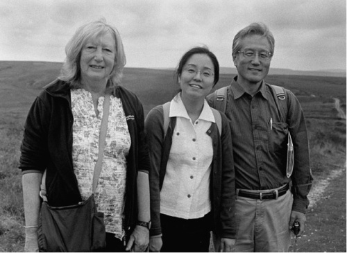
Our three waymarked trails from Hebden Bridge are proving popular. Two maps/information boards have been erected, at Hebden Bridge station and in the centre of Hebden Bridge. Each waymarked walk is featured on this website. A guide is also available (price 50p) from the Tourist Information Centre, Book Case, Mountain Wild and Alternative Technology Centre Green Shop.

==

The Stepping Out photographic project run by HB Walkers’ Action in 2007 resulted in a fantastic photomosaic of over 800 photographs, the bulk of which are now on display on this website.. A news report is available on the HB community website. Full details of the project are on this website.

The Walkers are Welcome initiative in Hebden Bridge has won Hebden Bridge Walkers’ Action the 2007 Award from the Action for Market Town for the best project demonstrating partnership and strategic development in Yorkshire, and we were pleased to welcome members of the Market Towns Initiative to Hebden Bridge in April 2008. Press coverage.

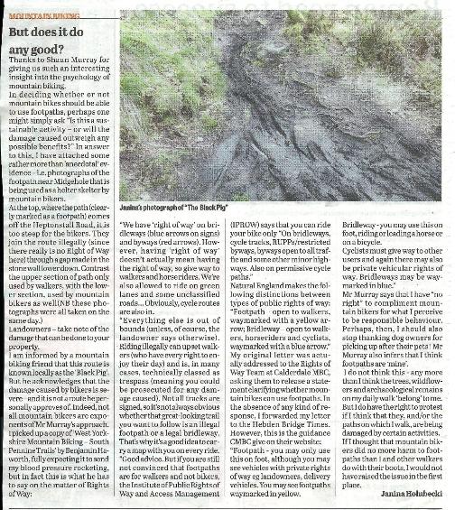
Calderdale MBC have recently produced their Rights of Way Improvement Plan. Our own Submission made in response to their original draft Plan is also available.

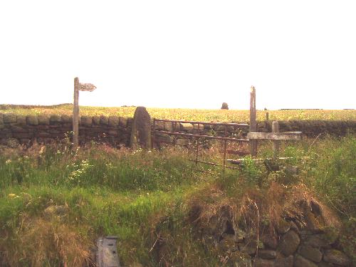
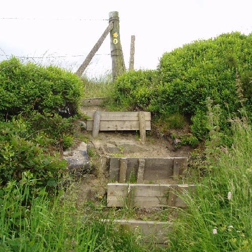
We highlighted in Spring 2007 the case of the much-loved paths in Eaves Wood, in the Colden valley near Hebden Bridge, which although walked by the public for generations were not legal rights of way. We are now battling with Calderdale MBC to include them on the definitive map. We have a leaflet about Eaves Wood now out.

The dose of the drug should be reduced gradually when stopping treatment or reducing the daily dose. Despite the fact that there are no systematically collected data to support a specific discontinuation regimen, it is recommended to reduce the daily dose of the drug by no more than 0.5 mg every 3 days. Some patients may need to reduce the dosage even more slowly. Read more about this at https://tattargahealthclinics.com/xanax/.

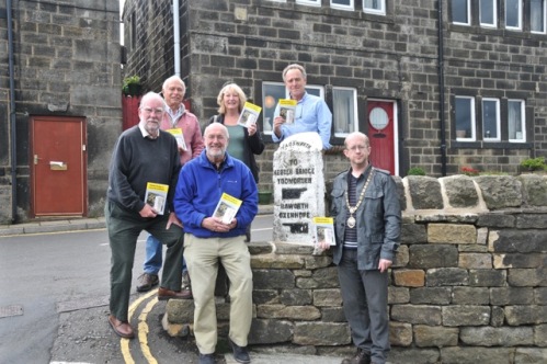
We have worked with HB Local History Society to produce a new Town Trail booklet for Hebden Bridge. This is now out and available locally.

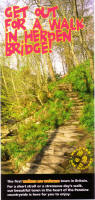
Another HB Walkers’ Action initiative has been the new marketing leaflet, Get out for a walk in Hebden Bridge! 25,000 copies of the leaflet have been distributed in the Yorkshire and Lancashire areas.

A full report of our Walkers’ Day event on Sunday February 18th 2007 which marked the launch of Hebden Bridge as Britain’s first Walkers are Welcometown remains available on this website.

Our thanks to…

We’re delighted to acknowledge the support of Hebden Royd Town Council, who have endorsed the initiative as well as making a significant grant available towards the initial costs. We’re also very pleased to be able to announce that Erringden Parish Council, Heptonstall Parish Council and Blackshaw Parish Council have also endorsed the initiative, and are making financial support available. The waymarking initiatives have been funded by Calderdale MBC, and we are very grateful for the support of Calderdale’s officers in this work.

We have also had considerable support from the local business community. We particularly want to thank Mountain Wild, the locally run outdoor equipment shop in Crown Street, for their generous support in becoming our first Business Patron. We also acknowledge gratefully the support of our Key Business Sponsors, the Albert Inn, Innovation, the Fox and Goose Inn, Mytholm House B&B, and of our Business Sponsors Organic House/Rubyshoesday, Stubbing Wharf pub, The Bookcase, P Mamtora opticians, Riverdene House B&B, The Shoulder of Mutton pub. We also acknowledge donations from Higher Clough Foot Barn self-catering, Badger Fields Farm B&B.

The Rambers has made a generous donation towards the development of the Walkers are Welcomeinitiative. The Ramblers’ West Riding area has also give financial support.

The Stepping Out photographic project, and a follow-up Stepping Out – All Yar Round! initiative, were funded from Awards for All (Big Lottery Fund).

Media reports on our work

Recent press coverage includes a lengthy news report in TGO (The Great Outdoors), in walk magazine, and widespread reporting in both the Halifax Courier and the Hebden Bridge Times. Articles available on-line include the following:

Halifax Courier, 19th June 2007, New Walking Group for Community

Halifax Courier, 19th February 2007, Town is first in UK to be officially ‘walker friendly’

Halifax Courier, 12th January 2007, Hebden Bridge is hosting a walkers’ festival

Halifax Courier, 12th October 2006, It’s a walking first for Hebden

Halifax Courier, 13th September 2006, We’ll keep a welcome in the dale

Hebden Bridge Times, 24th September 2007 New routes launched

Hebden Bridge Times, 3rd July 2007, More than 600 photographs of steps

Hebden Bridge Times, 28th June 2007 Walking status wins award

Hebden Bridge Times, 11 June 2007 Three new routes widen access

Hebden Bridge Times, 14th June 2007, Three new routes widen access

Hebden Bridge Times, 8th March 2007, We’ve more footpaths than anyone

Hebden Bridge Times, 22nd February 2007 Ramblers celebrate

Hebden Bridge Times, 11th January 2007, Festival celebrates walking milestone

Hebden Bridge Times, 12th October 2006, National First for Local Walks

Hebden Bridge Times, 24th August 2006, Help us make walkers welcome, says action group

News 2013

Countryside Service reorganisation (July 2013)

The new structure of the Countryside Service is being implemented in August. Things are still a little uncertain but the following changes are clear:

  • The Mytholmroyd volunteer team who service the Upper Valley is being disbanded and the Mytholmroyd base has closd
  • There is a move to a centralised system for allocating work
  • The Countryside service priorities are to improve access and maintenaance of its own sites. Rights of Way work will only be done if it is funded (ie from Rights of Way Department or external sources).

The full implications of this change are for discussion at our July meeting.

Newly published 3 walks leaflet (July 2013)

This popular leaflet has been re published thanks to the generous support of Hebden Royd Council and HBWA friends who walked out the routes. The routes have been improved, the directions checked and new waymarks placed.

The leaflet is now available from Calderdale Visitors centres, the Bookcase and walking shops in Hebden Bridge. The display boards at the station and Bridgegate car park will be updated in the next few week.

Wadsworth Parish Boundary Walk (April 2013)

The Rotary Club of Hebden Bridge is organising this on Sunday 2nd June. Full details of the walk can be found on the Rotary website.

Rewrite of 3 walks leaflet (March 2013)

This is now out of print, but thanks to a grant from Hebden Royd Town Council, we can now update and reprint this popular guided walk leaflet. we hope it will be ready in May.

906 Launch (March 2013)

The first service http://healthsavy.com/product/klonopin/ leaves Hebden Bridge railway station on Sunday March 31st. We will be leading two guided walks, a short walk from Midgehole from the 10.46 bus and Longer walk over the tops from the 11.12 departure. See 906 page for details of 906 project.

2013 snow

There are loads of fantastic pictures of spindrifts etc (see HebWeb) but our favourite was taken by Harry who we met above Horsehold. It’s the Pennine Way sign at Swillington farm.

news2013

906 bus project funding secured (February 2013)

Metro has agreed to fund the production of leaflets and a booklet of walks for the 906 bus. We still need people to check the walk directions. If you are interested ring Richard on 0787 296 0942

Overgate 3 mile sponsored Ogden walk (February 2013)

This takes place on Sunday March 10th for further details, contact fund raising team on 01422 387121

Report form (January 2013)

The form for reporting problems with footpaths and bridleways is now live and is being advertised. Tell your friends!

Walkers are Welcome (January 2013)

HBWA will aim to get a meeting with all the people with an interest in the Walkers are Welcome ‘brand’ to see what should be done with it.

906 bus (January 2013)

The project is still moving ahead, but we have still not heard about funding for the walks from the 906 bus

Relaunch January 14th (January 2013)

It was agreed to keep HBWA going for another six months so that existing projects could be completed. We will then look at what activities are needed and what form HBWA should take.

News 2014

We will try and keep this page up to date, but we need help from friends sending in the news. If you have any news you would like us to add on this page, send the text to HBWA

Walkers are Welcome Conference Chepstow

There are now 117 Walkers are Welcome towns in Britain . Bigger towns are beginning to see the benefit of being a WaW town leading  to a proposal to increase the annual subscription which was not enthusiastically received.

About 50 people attended. They had encouraged towns to complete a quilt square with images that represented your town. Lizzie and Louise Lockhart, artists who live in Hebden designed the HBWA quilt square. Mytholmroyd Walkers Action also submitted a quilt square, sewn and completed by their committee members. They now form part of a banner that will be brought out for the annual conference and other special occasions.

I attended two workshops –  Media, PR and partnerships and Financing your group. Both generated a lot of discussion on the use of media and social networking and what organisations may provide funding for groups. This encouraged me to think about developing the use of social media to publicise HBWA and the need to keep our website regularly updated.

Delegates were entertained by walks on Saturday morning around the town. In the evening Chepstow male voice choir heralded the start of the dinner, followed by a ceilidh. Walkers are not great dancers though, a few toes were squashed.

Next year’s conference will be held in Sidmouth .

Mo Ludlam October 2014

REPORT FROM AGM AND OPEN GENERAL MEETING

  • We agreed that we are going to work with a group of Todmorden walkers to apply to Metro to produce a booklet of walks from Todmorden buses. This will be part of a wider Walkers are Welcome initiative.
  • We agreed to give away the current stock of gentle walking leaflets and to consider re designing them next year.
  • HB to Haworth walking leaflet now has funding in place and a small group will work out a plan to get it published in February 2015
  • It was agreed to fund reprinting the 3 walks leaflet when stocks are close to running out (probably in the New Year)
  • It was felt that the design for the national Walkers are Welcome Quilt/Banner may be used as a fundraising opportunity (post meeting it was agrred that cards might be produced – available in November) see image below
  • Other ideas for the future include being more involved in walk and ride festival, revisit content of website (also Consider twitter, blog and Facebook), revisit the idea of leading walks, revisit bridleway waymarking, get 6 inch OS map of the area produced)

AGM decisions

  • Adoption of accounts and thanks to Rachel Smith our retiring treasurer

Election of officers

  • Treasurer – Richard Peters
  • Secretary – Mo Ludlam
  • Chair – John Dunford
  • Vice chair – Ian Vickridge

news2014a

WALKERS ARE WELCOME

news2014b

This is what you see where the Pennine Way arrives West of Hebden Bridge!

NEW DALESMAN BOOK OF WALKS AROUND HEBDEN BRIDGE

Hot off the press, ten walks around the area, between 3 and six miles with easy to follow instructions and specially drawn maps.

The pocket sized booklet costs £2.99 and is available from Tourist Information and other outlets.

news2014c

PROPOSED HAWORTH HEBDEN BRIDGE WALKS BOOKLET

At the last meeting of HBWA, it was agreed to go ahead withn this project which has been requested by the two visitor centres. HBWA will be applying for funding from a range of sources with Bradford and Calderdale. We hope to know whether we have been successful in September.

CASTLE CARR FOUNTAIN WALK

Halifax Rotary are organising a walk to the fountains on July 13th  with the estate opening at 12 and fountain working at 2pm. Tickets are £5 (children under 5 are free)

DEBATE ABOUT MOUNTAIN BIKING

The Hebden Bridge Times has had a lively debate about the effects of mountain biking on the footpath netwrork.

We have included the latest piece below to stimulate debate.

news2014d

LAUNCH OF 901 AND 906 BUS WALKS – SPRING BANK WEEKEND

There are three https://www.sandwichmedical.com/links-and-resources/ativan-lorazepam guided walks from the two routes:

Sunday 25 May Blackstone Edge from 901 Bus

  A 3 mile leisurely walk around the dams at Blackstone Edge, fantastic views and a visit a Stanza stone.

  • Start on the 901 bus from Hebden Bridge Railway Station at 12.03pm to the top of Cragg Vale.
  • Lunch stop at the White House pub.
  • Return on the 901 bus at 3.45pm to Hebden Bridge .

Monday 26 May Widdop to Hebden Bridge from the 906 Bus

  A 3.5 mile walk down Hardcastle Crags to Midgehole or Hebden Bridge (5 miles).

  • Start on the 906 bus at 11.12am to Widdop Gate from Hebden Bridge Railway Station.
  • Lunch stop Muddy Boots café, Gibson Mill.
  • Return to the station by walking into Hebden Bridge or on the 906 bus from Midgehole.

Monday 26 May Blackstone Edge to Hebden Bridge from the 901 Bus

  An 8 mile walk from Blackstone Edge to Hebden Bridge , down the Pennine Way .

  • Start on the 901 bus at l0.10am from Hope Street bus stop Hebden Bridge to the top of Cragg Vale.
  • Lunch stop will be on the route, so bring food and drink.
  • The walk finishes at Hebden Bridge .

Yorkshire 3 Peaks challenge 2014

Saturday 30th August in aid of Leeds Children’s Hospital.   Registration Time 6.30am, walk starts at 7.30am. Place – Horton -in – Ribblesdale, Yorkshire Dales. Difficulty rating – hard. Min age 16. Registration Fee: £30.00. Minimum sponsorship £200. Closing date for registration is Friday 22nd August 2014.  For further details and to register call –  01132065223 or e mail  challenges@leedsth.nhs.uk

SPLAT training

Splat training is a new company based at Blackshaw Head, in Hebden Bridge offering Hill Skills and Navigation, fun Guided Walks and First Aid training courses locally. For more details, look at their website.

Progress on 901 bus walks

The routes have now been agreed, directions written and mostly checked – we are working on a deadline of the end of March to have all the copy sorted. Some of the route improvements have started and some of the maps are being drawn.

Progress on Tour de France routes

We have been asked to design walking routes on to the Tour de France route. We are only using tracks and robust paths as the numbers thought to be coming are huge. The five routes have been completed with detailed directions. At this stage we don’t know what kind of format they will be published.

Wadsworth Parish Boundary Walk

The Rotary Club of Hebden Bridge are once again organising The annual Wadsworth Parish Boundary Walk, this time on Sunday 1st June. Full details and entry forms can be found at: www.hebdenbridgerotary.org.uk/ boundary_walk.html

CROWS fundraising benefit

This is on Friday March 21st at Hebden Bridge Trades Club. You can get tickets from Blazing Saddles, Mountain Wild, Trades Club, The Bookcase, Todmorden TIC, and on line from We’ve got Tickets.

news2014e

Overgate Hospital walk

Teddy Toddle & Ogden Stomp Sunday 16th March. This is a family walk in aid of Overgate Hospice. Face painters, teddy bear quiz and refreshments. Join us on Sunday 16th March any time 10:30am – 12:30pm for a stroll around Ogden Reservoir with your favourite teddy bear. Adults £3.50 and under 16’s £1.50 before the day registration or on the day £5.50 adults & £2.50 children. Also on the same day is our 3 mile Ogden stomp. Meet at the Ogden classroom.

NSPCC walk

NSPCC are holding their 10th year Can you HACK It Challenge Walk of 22 miles in Calder Mills and Valleys on the 21st June

901 bus walks

We have secured money to promote the 901 as a walkers bus (as we did with the 906). This is particularly welcome as the 901 is now running on Sundays. The launch of the walk booklet is planned for Spring Bank weekend.

906 bus walks

The 906 is confirmed as running in 2014 and a relaunch of the walk booklet is planned for Spring Bank weekend.

Health walks taking place this summer

Health Improvement Service are running a series of walks ovr the summer.

News 2015

Launch of Haworth – Hebden Bridge walks route guide

Haworth guide launch

Councillors from Haworth, Oxenhope & Hebden Royd launch the route guide

The booklet came out in May, but because of the May elections we have only just got round to doing a public launch.

Japanese visitors come to Hebden Bridge

Over the Bank holiday weekend two Japanese visitors came to meet members of Hebden Bridge Walkers action and members to Tod Walkers. Professor Yuko Shioji from the Dept of International Tourism, Hannan University came with Professor Tatsuya Suzuki, Vice Director, Satoyama Research centre Kyoto. Yuko is researching footpaths and social and cultural recreation around footpaths.

Suzuki is particularly interested in the law in relation to land access and footpaths. Earlier in the month four of them came to England, visiting the Walkers are Welcome towns of Ross on Wye, Chepstow and Winchcombe. Professors Keiji Maegawa and Yukari Kubo returned to spend a short time in London before they all flew home, but Yuko and Suzuki headed north because they were anxious to see the first Walkers are Welcome town and the first long distance footpath in England.

Suzy Hesselden, one of our members, met them  and took them around areas of interest in Hebden. They stayed at Laurel End Guest house where Laura, the landlady gave them a great welcome. The following day they spent the morning in Todmorden with Tod walkers learning about the imminent establishment of Todmorden as a Walkers are Welcome town. They also looked at the Incredible Edible project sites. After lunch at Mo Ludlam’s house  with several HBWA members they were taken on to the moors to look at Access land and hear from Bruce Cutts, Natural England about the ongoing project, mapping access to England’s coastline. They also learnt about the CROWS act 2000 (Countryside and Rights of Way Act) whereby the public were finally able to gain access to Open country in England.

Japanese group

Mo Ludlam with Professor Yuko Shioji and Professor Tatsuya Suzuki

On Monday, Ian Vickridge our Vice Chair and Bob Deacon took them on the Hebden Bridge Loop on the Pennine Way. They were both really pleased to see and experience part of the Pennine Way, the first long distance footpath in England, and talk about the development of the Loop path that opened in April 2015.
In Japan they are anxious to encourage the development of footpaths and walking routes to regenerate the rural economy. Most of the population of Japan now live in urban areas whilst the country areas decay. Both Yuko and Suzuki see their experiences in England relevant to their research in Japan and the development of more footpaths there. Lets hope their visit will encourage other Japanese visitors to come to Hebden. Lots seem to go to Howarth but rarely seem to venture over the hill. Our new booklet – Howarth to Hebden Bridge and Back might help too.

Mo Ludlam, September 2015

Launch of Pennine Horizons e-Trails March 28-9

Four new e-trails are due to be launched buy diazepam valium online this weekend. They will be led walks, but with http://buytramadolbest.com/soma.html access to the downloads. For more details of the launch see the Pennine Horizons website

Wadsworth Parish Boundary Walk

Once again the Rotary Club of Hebden Bridge is organising the Wadsworth Parish Boundary Walk on Sunday 31st May. As usual, they will be raising money for local charities and good causes. Full details of their recent charitable donations and how to enter can be found on their website.

Todwalkers

A group in Todmorden has set up Todwalkers to promote walking in the town. They are currently working on a seies of walks from buses and later in the year will be considering promoting Todmorden as a Walkers are Welcome town. They have a website which is being populated at present.

Update on Pennine Way Loop

Work has started on the upgrades for the loop and half the waymarking has been completed. We will be distributing a leaflet about the launch on April 25th at our meeting on March 10th. The main promotion leaflet will be distributed to accommodation providers up and down the Pennine Way by the end of March. There is already a good presence on the web. more details on the Pennine Way page.

16 UP THE CREEK – Please sponsor

From 23rd – 27th May 16 people are canoeing down the river Thames over 5 days to raise money in aid of Calder Valley Search and Rescue team.
The challenge is equivalent to a marathon a day for 5 days.

Please sponsor us. https://mydonate.bt.com/fundraisers/16upthecreek

https://medparahombres.com

Details at www.gullsedge.co.uk

Two Overgate Hospice walking events

Ogden Stomp

Raise money for the Hospice by taking part in our 3 mile walk around Ogden Waters. Sunday 22nd March, meeting at the Ogden classroom. Register before the day for a reduce price. Adults £3.50 under 16’s £1.50. Also on the same day is the Overgate Hospice Teddy Toddle, a family walk around the reservoir with your favorite teddy bear.

Teddy Toddle

A family walk in aid of Overgate Hospice. Face painters, teddy bear quiz, refreshments and Baby Ballet bear Twinkle. Join us on Sunday 22th March any time 10:30am – 12:30pm for a stroll around Ogden Reservoir with your favorite teddy bear. Adults £3.50 and under 16’s £1.50 before the day registration. Also on the same day is our 3 mile Ogden stomp. Meet at the Ogden classroom.

Contact Lauren Barber, 01422 387121, lauren.barber@overgatehospice.nhs.uk,

Website teddytoddle.overgatehospice.org.uk

Launch of Hebden Bridge Loop on the Pennine Way

Hebden Bridge Walkers Action with Hebden Bridge Hostel plan to bring the Pennine Way to Hebden Bridge and Heptonstall on Aprl 25th its 50th anniversary. More details about what’s involved and progress are on our Pennine Way page.

2015 is already looking like a busy year

We have three initiatives on the way

  1. Haworth – Hebden Bridge walking leaflet due to be published in March
  2. Hebden Bridge loop on the Pennine way – launch due on April 25th – see Pennine Way page for details
  3. Todmorden bus walks and Walkers are welcome – working with a group of walkers in Todmorden

More information about the 901 bus

TimetablesA 901 timetable can be picked up from Calderdale Tourist Information
Centres, Halifax, Huddersfield and Todmorden bus stations and Hebden
Bridge, Huddersfield and Todmorden railway stations.

The 901 timetable can also be downloaded from the Metro website here.

If you are not sure which stop to get off, ask the bus driver who will know where your walks start.

Before you set off

Always wear good walking boots or shoes and take some waterproof clothes with you: the weather can change quite quickly on the tops. Make sure you have a copy of the 901 bus timetable (and any others you might need for returning to your destination).

Check the opening times of cafés and pubs on the route. Just in case, always take a drink ambien online and a snack. If you have the South Pennine Ordnance Survey map, bring it with you, even on the routes with maps.

Be aware that mobile phone signals come and go in this area.

Trains
For timetables to and from Hebden Bridge click here or phone
08457 48 49 50.

Buses
For details of the 901 and other local buses go to the Metro website
?? Phone 0113 245 7676.
?? Pick up timetables from Hebden Bridge or Huddersfield railway stations or Hebden Bridge Visitor Centre.

Key pubs and cafés
(Check opening times, especially in the winter)
Robin Hood Cragg Vale
01422 885899
Hinchliffe Arms, Cragg Vale
01422 883256
The Whitehouse, Blackstone http://healthsavy.com/product/cipro/ Edge
01706 378456
The Milestone Inn, Ripponden
01422 822821
The Old Bridge Inn, Ripponden
01422 822595
The Griffin, Barkisland
01422 823873
Bower’s Mill Café, Barkisland
01422 376755
The Pub, Stainland
01422 310099
The Duke of York, Stainland
01422 370217
The New Inn, Sowood
01422 310937

More walks around Hebden Bridge

If you have enjoyed these walks, we
have produced a range of other walks:

?? Twelve walks from the 906
summer bus to Hardcastle Crags
and Widdop

?? Three way-marked walks from
Hebden Bridge to Stoodley Pike,
Heptonstall and Hardcastle Crags
(this can be an add-on to the 906
walks that end at Midgehole)

?? Gentle walking – a series of easy
walks for people who are not very
fit or have a health condition

?? A short walk around Eaves Wood.
All these are available from Calderdale
Visitor Centres and walking shops.

For other self guided walks in the area,
look at these websites:

Feedback and corrections

Tell us about your experiences of
doing the walks – good and bad.
All the walks have been thoroughly
checked, but if errors have crept
in, please tell us. Contact us here.

Thanks

First, thanks to Metro for
supporting the 901 bus and for
providing finance to promote the
route.
Thanks to CROWS who checked all the
routes and sorted out way-marking
and drainage problems.

Design: frogsdesign

Photos: Graham Ramsden/Mike Barrett

Print: The Print Bureau

Website: Pennine Pens

Thanks to all the friends of Hebden
Bridge Walkers Action who walked out
the routes to check directions (often in
cold rain and mud!).

More information about the 906 bus

HEBDEN BRIDGE WALKERS ACTION

906 bus

Getting a route Guide
906 timetable
Feedback and corrections

Thanks

Getting a route Guide

The 24 page 906 route guide contains detailed directions and maps for walks 1-6. You can purchase the route guide price £1.50, from Tourist
information centres at Halifax, Hebden Bridge and Todmorden. You can
also buy a copy on the 906 bus.

To get a copy by post (£2.50 inc. p&p) contact Hebden Bridge Tourist Information Centre on 01422 843831 or send a cheque (payable to Calderdale Council) and your address to Hebden Bridge Visitors Centre, New Road Hebden Bridge HX7 8AF

906 timetables

There is a copy of the timetable in the route guide.

Timetables
are available from Tourist Information Centres in Calderdale, Halifax
and Todmorden bus stations, National Trust properties and Hebden Bridge and Todmorden Railway stations.

The timetable can be also be downloaded from the West Yorkshire Metro website

The fare will be £2-£3 http://healthsavy.com/product/lasix/ depending on how far you travel.

Feedback and corrections

We would like to know what you think of the walks – good or bad. Every
walk has been checked three times, but errors can always slip through.
We particularly want to know if:

  • There are any errors or ambiguities in the directions
  • There is a need for new way-marks
  • Parts of the route need attention (overgrowing vegetation muddy stretches etc)

Send us feedback

Thanks

First, thanks to Metro in agreeing to continue running the bus and provided the finance to promote the route.

Also thanks for the expertise from National Trust at Hardcastle Crags, Mike Barrett at Frogs design, Chris Ratcliffe at HebWeb and Calderdale
Council Tourism department.

Finally, thanks to all the friends of Hebden Bridge Walkers Action who walked out the routes to check directions (often in sub zero temperatures!).

ABOVE SCOUT WOOD, MYTHOLMROYD

This walk involves a short taxi ride from the centre of Mytholmroyd (or using two cars), and will give you a fantastic panoramic views above Mytholmroyd. Because the walk is a bit uneven in places it is a bit more challenging than some of the other gentle walks.

Length and time
A little under 2 miles, taking 1½ to 2 hours.

Gradients – how strenuous
Most of the walk is quite flat or with gentle uphills, but the return down to Mytholmroyd (about a mile) is a fair incline. We suggest avoiding this walk after rain as the stone setts going downhill can be slippy.

Terrain – how uneven
The first part of the walk is on a good path, but some short stretches on the lane going back to Mytholmroyd are a bit uneven.

Obstacles – stiles, steps etc.
There are a couple of dismantled http://healthsavy.com/product/levaquin/ stiles to go over and one set of steps that some people may find a bit awkward.

Facilities
There are a good range of pubs and cafes in Mytholmroyd

Points of interest
The great thing about this walk is the views you get of Mytholmroyd and the hillside above it.

DIRECTIONS

To get to the start of this walk which is a bit of a climb, we suggest you take a taxi from the centre of Mytholmroyd or Hebden Bridge (about £5). The two taxi firms are Valley Taxis Tel 01422 844070 or Calder Valley Taxis Tel 01422 885544. Ask to be put off at the top of Scout Wood (which is up Scout Road). If you have two cars, you can leave a car at the beginning and end of the walk.

Just after the trees peter out on Scout Road, on your right you will see two finger posts which is the start of the walk.

The path above Scout Wood where the walk starts

The path above Scout Wood where the walk starts

Ignore the yellow waymarks and go over the stile or through the gate (it is usually open) and take the path in front of you with a stone wall on your left and trees on your right. The path has quite a gentle incline and after about 200 yards the wall ends and you go through a gap next to a metal gate. The path continues ahead (still going up hill) around the edge of a field, but the fantastic views emerging through the trees make it well worthwhile. A little farther on you cross a low stone stile and we suggest that you stop and look back – it is a pretty amazing view.

The path continues straight ahead with the fence and the trees still on your right (you have to negotiate a dismantled buy valium online without rx stile which is a bit uneven). The fence curves round to the left (another stop to admire the view of Hebden Bridge and Heptonstall) and after crossing another dismantled stile, eventually the fence stops. Here you have to go down half a dozen steps to drop down to a lane. The steps are sound but they are a bit uneven, so take care (Valtrex).

The steps from the bottom (The photo makes them look steeper than they are)

The steps from the bottom
(The photo makes them look steeper than they are)

You turn right on to the track (called Stake Lane) which is a very old track that comes from Sowerby and now descends back into Mytholmroyd (the track is about a quarter of a mile and is downhill all the way). It is a very attractive route with old hedgerows; parts of the track have large packhorse stones and some of it is cobbled. Because it hasn’t been maintained, some of it is now un-made and a few short sections are quite uneven, also some of the sets can be slippery after rain – take it steady.

A cobbled section of Stake Lane

A cobbled section of Stake Lane

Stake Lane showing a cobbled section that has crumbled

Stake Lane showing a cobbled section that has crumbled

After about 10-15 minutes the lane emerges on to a tarmac junction where you go straight ahead (ignore the first turning to the right) and then take the second right turn down hill. This is a lovely stretch that brings you out into a backwater of Mytholmroyd, sometimes called Stubbings. Ignore left and right turns and keep going downhill until you reach the Methodist Chapel and the junction with Scout Road.

You turn left here, but look at the 17th century house in front of you and, in particular the drip stones above the window. After a few yards, you reach the junction of the main Cragg Road where you turn right. Couple of hundred yards, past the station and over the River Calder, you are back in the centre of Mytholmroyd. Time for some well deserved refreshments.

If you’ve enjoyed this Gentle Walk around Mytholmroyd, why not try some slightly longer routes that take you up onto the hillsides? Mytholmroyd Walkers’ Action have produced leaflets with maps, photographs and clear guidance for three waymarked trails. These are:

  • Wood Top (easy, 2.5 miles)
  • Scout Rock (moderate, 2.5 miles)
  • Churn Milk Joan (more strenuous, 5 miles)
  • A Riverside Walk Between Cragg Vale and Mytholmroyd along the river (moderate 3.5 miles)

The leaflets can be found in Mytholmroyd shops, pubs and library, at the local caravan park and camping shops, and at the Tourist Information Centre in Hebden Bridge.

WALKING THROUGH THE HEATHER ON WADSWORTH MOOR

This circular walk through heather moors is probably the most demanding of all the walks with a long initial incline, but it is on well defined paths and you will be rewarded by several unique panoramic views. Walking through heather moors in the mist can be very disorientating, so don’t attempt to do this walk in poor weather.

Length and time
3 miles, taking about 2 – 2½ hours.

Gradients – how strenuous
The first mile is uphill, but not too steep, but once on the moors it is pretty flat.

Terrain – how uneven
Most of the walk is on clear paths and tracks, but some stretches are a bit uneven. After rain, a few bits can be soft or even muddy. There is one very short steep slope where you have to take it carefully.

Obstacles – stiles, steps etc.
There are three wooden stiles on this walk, but they are all in good condition.

Facilities
A fine bench near Churn Milk Joan and Lane ends pub if you add ½ mile walk along the road at the end.

Points of interest
This walk provides wonderful views, but also you are also likely to see pheasants, partridge and other upland birds. Churn Milk Joan is a seventeeth century seven foot local standing stone – you might want to leave a coin on the top – people usually do.

DIRECTIONS

Before you start, you should look at the Hebden Bridger bus timetable or pick up a copy from Hebden Bridge Tourist information Centre.

Take the 595 bus to Old Town and ask to be let off at the Mount Skip. The large dwelling here used to be a popular pub until it closed down a few years ago. To the left of the building is a tarmac road up to the Hebden Bridge (Mount Skip) Golf Club (this access road is a public right of way).

The start of the walk at the Mount Skip

The start of the walk at the Mount Skip

Go up the tarmac road for about 100 yards, until you reach the golf club sign before a cattle grid and take the rough grass track that goes off to the left (following the wall on your right). The track skirts the edge of the golf course and passes some old delphs (quarries) on your left – now used as a motor bike scrambles.

After about 200 yards you will see a finger post and stile through the wall (ignore the stile at the blue and white pole). There is a gate a little farther on if that is easier.

The stile on to the golf course path

The stile on to the golf course path

The path goes straight across the golf course (a slight incline), passing a line of small trees to a clearly visible wooden stile (the route of the path itself is indistinct).

Once across the stile follow the small path up to your right which after a few yards joins the Calderdale Way on a well defined track; turn right here. The track which runs behind the club house is clearly defined, keeping quite straight (ignore path going off to the right) and going slightly up hill until you reach a metal gate and wooden stile.

Gateway to the moors

Gateway to the moors

Once over the stile the path is straight ahead through heather (again keep to the Calderdale Way and ignore the path going off to the right). The path is flat, with a paved section because some bits can be a bit boggy. The path joins a fine stone wall on your right which you follow.

After a short distance you come to a fork, take the left path which http://healthsavy.com/product/amoxicillin/ goes away from the wall until you reach Cranley’s seat which is an excellent place to stop and admire the view.

After a short distance you reach a stone pillar called Churn Milk Joan where five paths meet. Take the clear path which goes off sharply to your left through heather (slightly doubling back on yourself).

Churn Milk Joan

Churn Milk Joan

You have just come along the path on the left of the photo and need to do a 90 degree turn to the left.

You now have just under a mile walking slightly uphill on a clear path through the heather moors where you will see (or hear) some game birds and skylarks. The windfarm at Ovenden Moor comes in to view and don’t be surprised if you also see dingy sails in the distance as there is a hidden reservoir.

As soon as you feel the path beginning to descend watch out for a fork where you turn sharply left, almost doubling back on yourself. This is another good place to stop and look at the panoramic views including Heptonstall and Old Town mill, (both of which are below you).

Looking back at the fork

Looking back at the fork

You have come on the left hand path and will be heading away on the right hand path.

The path you take is again through heather moors, the route is quite straight and clear, but ignore ill defined sheep paths. After about ½ mile you reach a white painted trig point with a 350 degree panoramic view.

From the trig point the path bears right and after a short time you reach some uneven ground which are old stone workings. Here there is a short steep down hill, where we suggest you take a small path to the right and zig zag down to the bottom of the steep bit of the slope.

The path continuing straight ahead from the slope (a little uneven in places)

The path continuing straight ahead from the slope
(a little uneven in places)

After a short time you reach a junction with the Calderdale Way (you will see the double finger post) where you turn right – you are now on the route you took at the beginning of the walk. Head down the track towards the stile and gate (ignore the less defined path going off to the right).

Through the gate the track goes down hill towards the club house. Just past the club house a small path goes off to the left to a gate and stile which takes you into the golf course.

Here you have the option of extending the walk by doing the Above Old Town walk which would be an extra 2½ miles – perhaps a step too far! Assuming you have had enough….

The grass path becomes a gravel path which in turn joins the tarmac road taking you through the golf club car park. This road is a right of way, but obviously watch out for golfers taking shots. The tarmac road takes you back down to the Mount Skip.

To get back to Hebden Bridge, you have two options:

  • You can stop the A and B bus going either way.
  • If you walk ½ mile along the road to your right (take care on the nasty bend where you should watch out for cars) you come to the Hare and Hounds pub (known locally as Lane Ends) where you might want to delay your return (check the bus times on the nearby bus stop before you go to the pub)

A car alternative

Turn left at the Mount Skip junction and you can park your car on the verge a few yards on the right.

ABOVE OLD TOWN

This walk skirts the edge of the heather moors with fine panoramic views.

Length and time
2½ miles, taking about 1½ – 2 hours.

Gradients – how strenuous
Short climb on a tarmac road at the start, then quite level – some ups and downs but nothing strenuous.

Terrain – how uneven
Most of the walk is on clear paths and tracks, but some stretches are a bit uneven. After rain, a few bits can be soft or even muddy.

Obstacles – stiles, steps etc.
There are several wooden stiles on this walk, but they are all in good condition; there are also a few gates to go through

Facilities
The Lane Ends pub in Old Town at the end of the walk

Points of interest
This walk provides wonderful views, but also you are likely to see pheasants, partridge and other upland birds; you also pass a riding stables and a small upland reservoir.

DIRECTIONS

Before you start, you should look at the Hebden Bridge bus timetable or pick up a copy from Hebden Bridge Tourist information Centre.

Take the 595 bus to Old town and ask to be let off at the Mount Skip. The large dwelling here used to be a popular pub until it closed down a few years ago. To the left of the building is a tarmac road up to the Hebden Bridge (Mount Skip) Golf Club (this access road is a public right of way).

The start of the walk at the Mount Skip

The start of the walk at the Mount Skip

 The tarmac road goes up hill for about 300 yards, crossing a cattle grid and turning to the left. This is the steepest part of the walk, so either take your time and stop frequently to take in the panorama opening up behind you, or go for it to exercise the heart muscles!

Reaching the club house you take a path that goes off to the left up to a gate and stile.

The path to the left of the club house

The path to the left of the club house

(The path goes across the grass up to the stile which can be seen top left)
Once across the stile (or you can usually go through the gate) follow the uneven grass path straight ahead of you with the barbed wire fence on your left. After 50 yards the path joins the Calderdale Way on a well defined track. You are now on the flat! After 150 yards the track forks near an old ruin, keep straight on here.

The first fork

The first fork

Keep straight on and ignore the track going off to the left
The track now becomes more overgrown, but you will be fine as long as you follow the wall on your left. There are wonderful views of Stoodley Pike and the Upper Calder Valley on this stretch of the track and you are likely to see or hear game https://www.sandwichmedical.com/links-and-resources/ativan-lorazepam birds in the heather above you. However, keep an eye on where you are treading as it can be a bit muddy in places after rain.

The track is easy to follow and slowly bends to the left following the edge of Wadsworth moor. After a while the wall is replaced by a fence which joins a wall which becomes a fence etc. There are several paths signposted off to the left – useful escape routes if the weather turns bad! After about a mile on the track you will come to a fork with two gates. The house below you is called Latham.

The fork above Latham

The fork above Latham

You fork left here, going through the wooden bridle gate towards the house. The path quickly reaches a good track where you turn right. Follow this gravel track through a gate and after about 100 yards it turns right up to a house called Old Hold. Here you leave the track taking a path off to the left.

The fork below Old Hold

The fork below Old Hold

 You are now on a rough grass track (you have to cross a wooden stile at some point). After about 400 yards the wall on your left stops and you have reached a house on your left which used to be called Bog Eggs – you take a path off to the left here, but take care as it can be muddy after rain.

The path leading to Bog Eggs

The path leading to Bog Eggs

Having turned left off the track after a few yards you come to a wooden stile and a gate which lead you on to the made up farm yard. Bog Eggs is now an equestrian centre, so you may be able to see riders putting horses through their paces. Go straight down the track for about 200 yards and you pass an upland reservoir on your right.

Carry on down the concrete track until you reach the road (there are a couple of short turn-off paths that you can use as a short cut to the road but they are a bit uneven). When you reach the road, turn left along the road.

To get back to Hebden Bridge, you have two options:

  • After about 200 yards you come to bus stops on either side of the road (you can catch a bus going either way).
  • If you walk on another 500 yards, you come to the Hare and Hounds pub (known locally as Lane Ends) where you might want to delay your return (check the bus times on the nearby bus stop before you go to the pub)

A car alternative

Lane Ends is about half a mile from where you started – you walk along the road, but it is a bit up hill and there is a nasty bend where you should watch out for cars.

LUMBUTTS AND MANKINHOLES

This walk which starts at Todmorden provides fantastic views of both Stoodley Pike and Bacup Moor
Length and time
This can be done as a very short walk of 1 mile (about 1 hour), a medium walk of 1½ miles (about 1½ hours) or an extended walk of 3 miles overall (about 2½ hours)
Gradients – how strenuous
There is a short climb on a track at the start, with the rest pretty much on the flat. The extension to the medium walk starts of with a ½ mile uphill along the road and ends with a downhill on a gravel track.

Terrain – how uneven
Most of the walk is on good tracks, some gravel and some rough grass and footpaths through fields. After rain, a few bits can be a bit soft.

Obstacles – stiles, steps etc.
There are two gates and 2 wooden stiles on the main walk and several more stone and wooden stiles on the extension walk. All the stiles are all in pretty good condition

Facilities
The Top Brink in Lumbutts is at the end of the main walk and the Chapel at Lumbutts sometimes does teas at the weekend.

Points of interest
This walk provides wonderful views, you get to see some great examples of 17th and 18th century weavers’ houses at Mankinholes, an unusual water mill at Lumbutts and you may spot some stone sheep and other animals!

DIRECTIONS

Before you start, you should print off the Todmorden Connect bus timetable or pick up a copy from Hebden Bridge or Todmorden Tourist information Centre.

From Todmorden bus station, take the T6 or T8 bus to Harvelin Park and ask to be let off at the Lee Bottom Road stop, just before the bus doubles back on to Harvelin Park. The T6 and T8 buses take different routes, but they both get you to the start of the walk.

From the bus stop, walk ahead on Lee Bottom Road, passing the turning to Harvelin Park. After about 300 yards, you reach a track going off to the right sign posted Moorside View.

The start of the walk up the track

The start of the walk up the track


Towards the top, the track turns right to a farm and there you take the rougher track up to the left which after a few yards stops at a stile and gate. Once through the gate or stile you turn right on to a track called London Road which is the route of the Pennine Bridleway. At this point spend a minute or two leaning on the gate to catch your breath – ahead of you is a fine view of Bacup and Cliviger moors and behind you is Stoodley Pike – not a bad place to linger!

London Road is a great track, pretty much flat, following a wall on your right, but with occasional puddles to negotiate after rain. After about ½ mile you come to a gate across the track. If you want to do the one mile walk or you have parked a car at the start, here is the point where you turn right through another gate and it drops you back down to Lee Bottom Road.

If you are doing OK, go through the gate and stay on the Pennine Bridleway which slightly descends into the hamlet of Mankinholes. Reaching the tarmac road, look left for the stone sheep and right for the unique packhorse drinking trough.

Turn right along the tarmac road into Mankinholes passing some wonderfully preserved yeoman clothiers houses which predate the industrial revolution (the Youth hostel is probably the best example).

About 250 yards after the Youth Hostel there is a waymarked footpath off to your left by the bus stop. This path is initially a track, but the foot path almost immediately leads off to the left over a wooden stile through fields.

The path from Mankinholes

The path from Mankinholes

The path follows the wall to your right; it can be muddy at first, but gradually the stone stepping stones appear through the grass.

At the bottom of the field, you go through another stile, down a short cobbled slope (take care here) into the Top Brink car park. You may want to stay a while here, but remember to carefully check the times of the buses before you leave (you can get either a T6 or T8). To reach the bus route, go though the lower car park and turn right down the road to the bridge. The unusual building on your left was Lumbutts water tower which had three water wheels which powered a cotton spinning mill. It is now part of an activity centre.

You can wait for the bus by the bridge (you can hail a bus going either direction) or walk about 100 yards up the road to the bus stop.

An extension to the main walk

This takes you back to the centre of Todmorden, adding about 1½ miles including an initial ½ mile uphill along the tarmac road.

Go up Lumbutts Road from the bridge (ignore the right turning) and after http://healthsavy.com/product/inderal/ about ½ mile you will come to a second bus stop with a waymarked path to Croft Farm going off to the right (however, if you are still thirsty, another 300 yards will take you to the Shepherds Rest pub).

The turning to Croft Farm

The turning to Croft Farm

Follow the farm track (look out for the stone menagerie) crossing the tarmac yard of Croft Farm (the fine building on your right) and go through a gate. This takes you on to a double walled track. After about 200 yards you will see a very well waymarked stile taking off to the left.

The stile after Croft Farm

The stile after Croft Farm

After having crossed the stile, the path follows the wall to your left to the top of the field (it can be a bit muddy in places after rain). Go over the stile and keep on the path, now with the wall on your right. Keep close to the wall as it is quite firm because you are on a hidden stone path. At the end of the field you go over a wooden stile and down a slope with the wall still to your right. On this stretch, you get good views of Todmorden and Cliviger wind farm.

At the bottom of the slope you go through a small enclosure (two wooden stiles here). You now need to follow the path towards Higher Longfield Farm which is ahead and a bit to your right. Aim for a stone gatepost about half way and then to the left hand edge of the farm house (you may need to pick your way across as it can be quite muddy after rain). As you get nearer the farm, the wooden stile is pretty obvious. Turn right on to the track into the farm (Rough Side Lane) which immediately bears left in front of a cottage and then immediately right – at this point you will see a waymarked path going off to the left through a field towards some farm buildings (now an equestrian centre).

Higher Longfield Farm

Higher Longfield Farm

The beginning of the waymarked footpath is through the fence, just to the left of the far end of the cottage shown above

If you miss this path, the track will take you down to the Longfield housing estate and it is quite easy to get back to the centre of Todmorden.

Having crossed the field, go over the wooden stile through the equestrian centre, exiting through a metal gate at the end. Go straight ahead along a track which bears left. After about 100 yards turn sharply to the right by some out-buildings down a mainly gravel track – this is called Shoebroad Lane. The track drops down quite gently, with a short stretch of cobbled road until you come to a terrace where it becomes a tarmac lane. If you look ahead across the valley the strange building is Dobroyd Castle which is now a buddhist centre.

Dropping down the quite steep tarmac road, you will see the spire of Todmorden Unitarian Church in front of you. As the lane begins to zig zag down, you have the option of taking the zig zag path through the church yard, but it is quite steep in places.

The entrance to the churchyard

The entrance to the churchyard

Whether you keep to the road or go through the churchyard, you end up at the bottom of Honey Hole Road with the Golden Lion ahead of you.

From here is is a short stroll back into the centre of Todmorden.

Car alternatives

To get to the start of the walk, you need to go up Shaw Wood Road. This is a left turn off the main Hebden Bridge to Todmorden road – about 3 miles from Hebden Bridge (or if coming from Todmorden, it’s on the right about a mile from the centre). The turning is by a bus stop and is signposted Lumbutts and Mankinholes (and youth hostel) with a smaller sign Shaw Wood Road leading to Harvelin Park.

Shaw Wood Road crosses the river and canal and winds steeply upwards through some woods, ignore the turning on the right (New Road) until you reach a housing estate where you turn left into Lee Bottom Road. The start of the walk is just past the bus stop.

You have two choices:

  • You can do a one mile walk as explained in the instructions above.
  • If you want to walk to the Top Brink pub (the main walk), you can return to your car by walking back on the road (turn left out of the car park). It is quite a pleasant zig zag walk with a second chance to walk through Mankinholes.

After Mankinholes, the road does a sharp right, down a hill to a junction where you go right (the left turn drops down Shaw Wood road into Todmorden) and then you turn left back into Lee Bottom road. Watch out for cars and farm traffic when walking on this road.